Posts

Showing posts from October, 2017

Turn right, head south...

Image
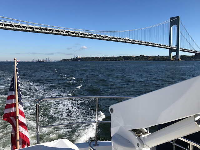
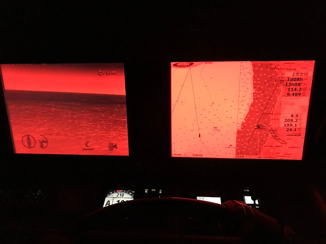
Plan B 9:00 AM, the weather is fantastic and seas are predicted to reduce to dead calm as the day progresses.   We decide that cruising south makes more sense than stopping at Sandy Hook.   With the Verrazano Bridge in our “rear view mirror” we begin the run parallel to the New Jersey shore towards Cape May and Delaware Bay.   Running offshore Blue skies, calm seas, white puffy clouds set the scene.   This is cruising!   We take turns at the helm and “off watch” time is for relaxing. Based on input from our cruising buddies (Gale Plummer and Dennis Fox) Plan B is to run through the night and reach an anchorage near the Chesapeake Delaware Canal in the morning.   As the sun sets, we pass Atlantic City all lit up for a night of gambling and entertainment. Atlantic City - Dusk Atlantic City - Night Nighttime Cruising We turn on the FLIR night vision to assist in watching for fishing boats.   As we approach the entrance to Delaware Bay, we alter the cr

New York, New York!!!

Image
Go for the gusto Now the fun begins.  Due to mechanical and weather delays, we are about three weeks late on our cruising south schedule.  Tropical storms and hurricanes continue to develop and wander around in the Atlantic Ocean causing problems for a whole lot of people, including us.  Originally, we planned to take about a month to cruise down the Atlantic coast at a leisurely pace of 30-40 miles per day. With October 1 st right around the corner, the days shortening to less than 12 hours of sunlight, and favorable weather windows becoming less frequent, our cruising friends encourage us to push our limits and do 50-80 miles per day.  Longer travel days means starting before sunrise, and anchoring in unfamiliar harbors after dark. We exit New Bedford Harbor bound for Block Island… 50+ miles southeast.  The weather is picture perfect and the sea is nearly dead calm so we decide to push another 30+ miles to Orient, on the eastern tip of Long Island.  After sunset, we cau

Hurricane Time

Image
Plan B One of the challenges to cruising is having a plan, and an alternate plan… and another alternate plan.  Uncooperative weather and water conditions come in many sizes, shapes, and forms.  Wind, waves, fog, currents, tides, sunrise, and sunset all factor into when and how you get from point A to point B.  Thankfully, cell phone/IPad, and GPS-based technology provides much more information to mariners through NOAA and other websites/apps.  Based on information available, we chose New Bedford, MA to wait out the latest hurricane. Hurricane Jose Hurricane prep As described in the previous blog, we arrived in New Bedford on Sunday and secured a heavy-duty mooring buoy to wait out Hurricane Jose.  Instead of the standard mooring line, we used our heavy-duty anchor bridle that includes a metal to metal loop and shackle increasing strength and reducing line chaffing.  Our dinghy is secured on top of the aft deck and so far, nothing on the boat has blown away.  We cover