New York, New York!!!
Go for the gusto
Now the fun begins. Due to mechanical and weather delays, we
are about three weeks late on our cruising south schedule. Tropical storms and
hurricanes continue to develop and wander around in the Atlantic Ocean causing
problems for a whole lot of people, including us. Originally, we planned to
take about a month to cruise down the Atlantic coast at a leisurely pace of
30-40 miles per day.
With October 1st right around the corner, the
days shortening to less than 12 hours of sunlight, and favorable weather
windows becoming less frequent, our cruising friends encourage us to push our
limits and do 50-80 miles per day. Longer travel days means starting before
sunrise, and anchoring in unfamiliar harbors after dark.
We exit New Bedford Harbor bound for Block Island… 50+ miles southeast. The weather is
picture perfect and the sea is nearly dead calm so we decide to push another
30+ miles to Orient, on the eastern tip of Long Island. After sunset, we
cautiously follow the red and green blinking buoy lights into a protected
harbor and anchor for the night. This is
the first time we used our FLIR system, which is night vision on steroids, and
boy that sure did help!

Orient to Port Washington, NY
We plan to get up at 5:15 AM for an early start to a long
day, about 80+ miles east to Port
Washington, NY. At 4:30 AM we are jolted awake by the blaring alarm from Karl’s
anchor watch app. It is set to alert us when the anchor drags. We scramble to
the pilothouse, check the instruments and our surroundings. Still
pitch-black outside, but we seem to be stable. Oh well, since we are already
awake, we prep to pull anchor and depart as soon as there is some light in the
eastern sky. Today is the direct opposite weather and sea conditions from
yesterday. Dark threatening clouds, lightening, wind, and rough grey seas. Unfortunately, the tide on Long Island Sound is going out through The Race, a narrow opening at the
eastern end, and the wind is blowing 25+ knots to the west against the exiting
tide. This defines the term “swimming upstream”. After twelve hours of pushing through
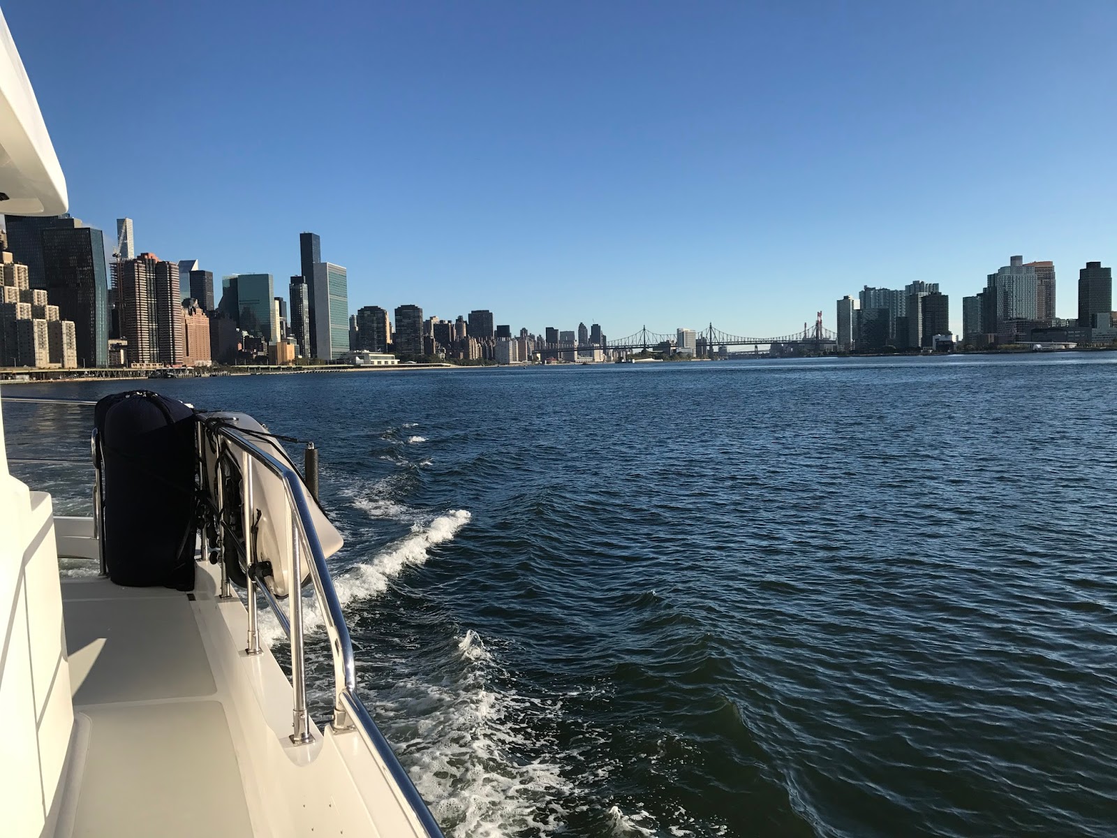
Long Island Sound, we get our first glimpse of NYC from the water. Then, turn
into Port Washington harbor at sunset, anchor in 30 knots of wind. Last task
before bed, load the waypoints for tomorrow’s route into Bravo’s navigation
software. Then crash. We are pooped.
NYC, Hell Gate, and beyond
The next day is our transit through NYC via the East River
and Hell Gate, around Wall Street, the Battery, and on to Ellis Island and the
Stature of Liberty. Because of the narrow waterways, timing the transit for favorable tides and currents is critical. We depart Port Washington to enter
Hell Gate between 8:00 and 9:00 AM. We pull anchor around 6:30 AM. Yesterday’s
wind has died down to more reasonable levels and the sun rises on beautiful
clear blue skies. Carefully following a sailboat through the buoys in the early
light, we exit Port Washington and turn left, west, towards Manhattan. A tug
pushes a large barge past us as we stare at the skyline and bridges unfolding
on the horizon.

Our route from Port Washington through New York City
The weather is exquisite, wind is zero, and the water is
dead calm. As we get closer, you can pick out each iconic building on the
horizon from the Bronx, through mid-town Manhattan, downtown Wall Street, and
on to Brooklyn. Two sailboats and Bravo make a small parade cruising slowly towards
the “Big Apple”. We hug the green (starboard) side of the channel to allow
commercial traffic full access to the main waterway. Two more pairs of tugs and
barges pass us heading east towards Long Island Sound. Because of the narrow
waterways and number of boats we decide to not use the Auto pilot and Nora hand-steers
the course. To ensure we don't miss a thing, Karl is today’s designated
photographer.

Using information on the charts and from memory we identify
highlights and landmarks along the shoreline and the bridges as each one passes
over our heads. Throgs Neck Bridge, SUNY Maritime College, Whitestone Bridge, LaGuardia
Airport, Rikers Island. Abandoned waterfront structures such as the old hospital and factory on North and South Brother Islands. Others unidentified. We examine a strange barge tied to the shore and suddenly
realize it is a floating prison. It looks like something out of Waterworld.

Too weird! This is a prison, complete with outdoor razor wired exercise area!
Carefully we follow the red and green buoys marking our way
through the city’s waterways and begin our transit through Hell Gate, right on
time. There is no turning back as the current pushes us ahead three knots over
our boat speed. To the right is the FDR East River Drive. It is only about 20 feet off the starboard side of the boat. We pass the shoreline so close you can almost fist-bump the joggers and you can
feel the draft of the cars zipping along the highway. Many waterfront buildings
of the upper East-side are built over the highway their foundations going
directly into the river. To the left, Roosevelt Island unfolds. This is a unique
and intimate view of NYC not possible from any other mode of transportation.

We notice water traffic is light and we are the only boat in
Hell Gate going in either direction. Ahhhh! BONUS… It’s Sunday morning in NYC. Not only is it perfect weather, but the plethora of commercial traffic we
anticipated is not going to materialize. We continue to enjoy the ride. A
succession of easily identifiable bridges; Triborough, Hell Gate, 59th Street, Manhattan, Brooklyn Bridge span the river. Many of them have several levels. Cars, trucks,
bikers, and pedestrians moving back and forth look like toys as we glide under
them. The United Nations building rises on the right. The new “World Trade
Center” building is prominent on the downtown skyline.


United Nations

Approaching southern Manhattan, boat traffic picks up…
namely the Staten Island Ferry and numerous high-speed ferries going at frantic
“NYC speed” in every possible direction. Believe me… they do not slow down or
stop for anyone. We watched a small pod of runabout boats, scatter like leaves
as a high-speed ferry approached and charged through their fishing ground.
Entering New York Harbor, Ellis Island and the Statue of
Liberty greet you. We cruise as close to Lady Liberty as security barriers
allow and take our selfie with her. Certainly, one for the records.


The size and scope of New York Harbor is hard to describe in
words. From the north, the Hudson and East Rivers converge and merge with the edge
of the North Atlantic Ocean. Immense industrial ports on the New Jersey shore
go on forever. On the left you can see Coney Island gracing the Brooklyn waterfront. Staten Island and
the Verrazano Bridge are ahead.
Here there is no Sunday reprieve from commercial traffic. AIS
markers are lit up all over the navigation screen. Tankers, container ships, cruise
ships, and of course, ferries, crisscross and move in every direction. Following
our navigation plan, we continue to hug the “green side” of the channel giving
everyone as much room as they want and need.

Continuously monitoring VHF Channel 16 a Coast Guard “Pan-pan”
call is made for a sailboat adrift off Rockaway Beach. Blue lights flashing, Coast
Guard, NYPD boats, and helicopters head to the scene off our port side. Through
the binoculars the rescue is noted and we continue out of the harbor.


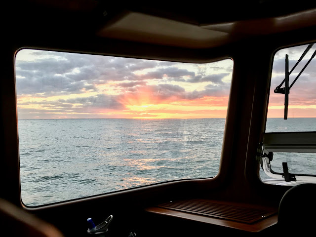
The cruise plan is to anchor off of Sandy Hook for a few hours rest, take advantage of a really positive weather window off the New Jersey coast to do an overnight run to Delaware Bay. However, since we made such great time through NYC, and it is only 9:00 AM, we are reconsidering our plans.

Comments
Post a Comment