Turn right, head south...
Plan B
9:00 AM, the weather is fantastic and seas are predicted to reduce
to dead calm as the day progresses. We
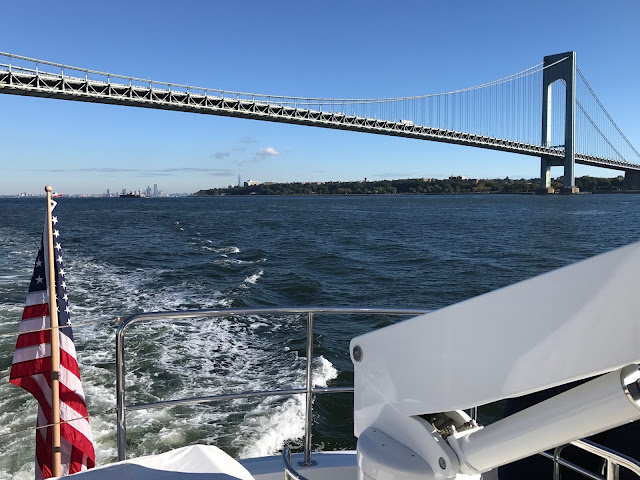
decide that cruising south makes more sense than stopping at Sandy Hook. With the Verrazano Bridge in our “rear view
mirror” we begin the run parallel to the New Jersey shore towards Cape May and
Delaware Bay.
Running offshore
Blue skies, calm seas, white puffy clouds set the scene. This is cruising! We take turns at the helm and “off watch” time is for relaxing.
Blue skies, calm seas, white puffy clouds set the scene. This is cruising! We take turns at the helm and “off watch” time is for relaxing.
Based on input from our cruising buddies (Gale Plummer and Dennis Fox) Plan B is to run through the night and reach an anchorage near the Chesapeake Delaware
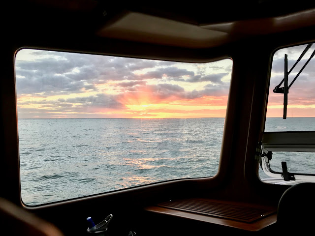
Canal in the morning. As the sun sets,
we pass Atlantic City all lit up for a night of gambling and entertainment.
Atlantic City - Dusk
Nighttime Cruising
We turn on the FLIR night vision to assist in watching for fishing boats. As we approach the entrance to Delaware Bay, we alter the cruise plan for the second time. Quick recalculations show that by continuing south and offshore, we can reach the entrance to Chesapeake Bay by the following evening. The weather window is predicted to hold in calm seas and clear skies. So, we shift the course east to run along the Delaware coast.
We turn on the FLIR night vision to assist in watching for fishing boats. As we approach the entrance to Delaware Bay, we alter the cruise plan for the second time. Quick recalculations show that by continuing south and offshore, we can reach the entrance to Chesapeake Bay by the following evening. The weather window is predicted to hold in calm seas and clear skies. So, we shift the course east to run along the Delaware coast.
Running at night with two people means alternating shifts of
about 3 hours each. Karl takes first
shift while Nora sleeps. Nora relieves
Karl and he tries to sleep. Repeat until
the sun comes up.
Chesapeake Traffic Jam
As planned, we reach the mouth of Chesapeake Bay at sunset. What a circus! This is busier than yesterday in New York Harbor! The navigation screen is cluttered with more AIS markers than we can count. One person steers while the other person watches the screen and monitors traffic. Huge container ships, multiple navy ships, ferries, tugs, barges, Coast Guard boats of all sizes compete for your attention.
The skittish Navy patrol boats with machine guns on the bow really don't like anyone getting close to the moored military boats. We watch them hurry over to a sailing catamaran to deliver that message and escort the cat to the main traffic channel.
As planned, we reach the mouth of Chesapeake Bay at sunset. What a circus! This is busier than yesterday in New York Harbor! The navigation screen is cluttered with more AIS markers than we can count. One person steers while the other person watches the screen and monitors traffic. Huge container ships, multiple navy ships, ferries, tugs, barges, Coast Guard boats of all sizes compete for your attention.
This ship looked like a mechanical Transformer!
The skittish Navy patrol boats with machine guns on the bow really don't like anyone getting close to the moored military boats. We watch them hurry over to a sailing catamaran to deliver that message and escort the cat to the main traffic channel.
The VHF radio is a continuous conversation between ship captains,
harbor pilots, ferries, tug boats, and “the little people” (pleasure craft). You listen for other boats hailing “Bravo” to
communicate their intentions to pass or cross your path. As the sun sets we continue up the tight but
well-marked channel to an anchorage for the night.
A good night’s sleep at anchor, a leisurely breakfast and we
are ready to head for Atlantic Yacht Basin (AYB). The 24/7 run from NYC to Chesapeake saved
enough time that we plan for an easy trip and a noon arrival. Or so we think. Unfortunately, when we try to start the
engine, nothing happens. Yikes! On the phone once more to James at Yacht
Tech. After a few preliminary FaceTime diagnostics
with James, Karl hot-wire jump starts the engine and we are on our way. Geesh!
The route upstream to Atlantic Yacht Basin (AYB) is lined with every imaginable type of Navy ship. The weather continues to be terrific and we enter the Great Bridge Locks in time for the 2:00 PM bridge opening. A few more turns and Bravo is tucked into her covered slip alongside sister-ship N55 Mondai Nai (Japanese for No Problem). We will be here for 2-3 weeks prior to the next stage of the trip... Intracoastal Waterway* to Florida.
*Wikipedia: The Intracoastal Waterway (ICW) is a 3,000-mile (4,800 km) inland waterway along the Atlantic and Gulf of Mexico coasts of the United States, running from Boston, Massachusetts, southward along the Atlantic Seaboard and around the southern tip of Florida, then following the Gulf Coast to Brownsville, Texas. Some sections of the waterway consist of natural inlets, saltwater rivers, bays, and sounds, while others are artificial canals. It provides a navigable route along its length without many of the hazards of travel on the open sea.


Comments
Post a Comment